
Peters Township Neighbor Sources
The immediate block is best researched one parcel at a time. Washington County’s map and property systems connect a site address with a parcel, owner field, and recorded-land trail. They do not create a complete roster for the street. The Township’s own maps help orient the address, and voluntary organizations offer community contact routes. Treat each source as evidence of the narrow fact it actually displays.
| Source | What It Shows About a Block | Access |
|---|---|---|
| Washington County GIS property map | Parcel boundaries, Site Address, owner result, Property ID, and links to county property resources | Free web search by property ID, address, or owner; select each parcel individually |
| Recorder plans and deeds | Legal adjoining-land, lot, plan, and title-transfer relationships | Landex or Recorder public computers; read the source document |
| Peters Township Street and House Number Map | Road layout, address sequence, and Township geography | Official Township map, current as of July 2024 |
| Regulated Street or Walking List | Defined voter-list fields for a requested street | Election-law request with certification; not a general web map |
| Community organizations | Voluntary public contacts, programs, or member-facing information | The organization decides access; no roster is presumed public |
The table separates location evidence from person evidence. Parcel lines and road maps help identify the block. A recorded plan can explain lots and easements. A property record may identify an owner or tax recipient, but it does not prove who occupies an address. The distinction prevents a block search from becoming a claim about people who are not named in the record.
Peters Township Parcel Records
The Washington County GIS property map has one type-ahead search for property ID, address, or owner. A result list displays Owner Name, Property ID, and Site Address, then opens a parcel detail panel with links that may include Assessor, Print Parcel Summary, and Tax Collector. The county’s Tax Revenue gateway is the companion entry point for Assessments, claims, parcel viewing, and the property-records public-access system.
Read the field label before relying on it. Site Address is where the parcel sits; an owner mailing label can point somewhere else. Either field can be useful for checking a land record, but neither is a household roster. A surrounding parcel may be held by several owners, a trust, a corporation, or another record holder. The map supports careful parcel research, not assumptions about daily presence.
Note: The map’s next and previous arrows move through a search-result list, not through physically adjoining parcels.
Map Peters Township Neighbor Parcels
Washington County did not verify a radius, buffer, or automatic nearby-parcel button in its GIS interface. The reliable method is visual: find the focal parcel, inspect it, and click touching or nearby parcel polygons one at a time. Irregular lot shapes, cul-de-sacs, easements, and subdivisions can make the next house number a poor proxy for legal adjacency.
- Enter the focal address, property ID, or known owner in the county GIS property map. Confirm the selected parcel’s Site Address and Property ID.
- Open the details panel, then use the map itself to select each surrounding parcel polygon. Record that parcel’s Property ID, Site Address, and the linked county path.
- Use the assessor or property record to check the parcel party and mailing label exactly as shown. Keep site and mailing fields distinct.
- For a legal relationship, follow the instrument number, book/page, legal description, or plan reference to the Recorder. Compare the documents before calling two lots adjoining land.
The workflow is address → focal parcel → touching parcel polygons → parcel fields → deed or plan. For a longer, named-street record trail, use the Peters Township Street Directory; the parcel-by-parcel method remains the right scope for one block.
Peters Township Deed Records
A deed or recorded plan can clarify what a map only suggests. Washington County states that deeds from 1781 to the present are available remotely through Landex. Begin with the parcel ID, current party spelling, site address, and any displayed legal-description or transaction reference. Search the present party as grantee to find the acquisition record, then use the seller as grantee to work backward when a predecessor trail is needed.
Land records may use lot, block, plan, tract, or adjoining-land language instead of the current street address. If a line changed through subdivision or a transfer involved an estate, trust, sheriff sale, or entity, consult the actual recorded instrument and the appropriate court or Register of Wills source. A plan can show lot sequence, but parcel geometry and legal description control over a guess based on street numbering.
Parcel terms. A legal description identifies land through recorded boundaries, lot, block, or plan language. A plat is a recorded plan that maps lots or a subdivision. A situs address is the location of the land itself, which is different from a tax mailing address.
Peters Township Voter Records
Pennsylvania’s official registration-status route is for a voter to check their own information online, by phone, or through the county office. It is not a public street browser. Washington County Elections maintains the registration database, and its voter-information requests use a form. A regulated list can be relevant to a defined election-related purpose, but it is not a tool for publishing a block directory.
The Department of State request form distinguishes Public Information, Street, Walking, and Full Voter Export lists. A Street List has name, residential and mailing address, party, and active or inactive status. A Walking List leaves out mailing address. The request requires county scope and a signed statement that limits use to election, political, or law-enforcement purposes, with no internet publication. Registration history records participation, not ballot choices.
Washington County Elections is the custodian for County requests, and the state form sets the current process and list fields. Protected participants can use a substitute address, so the absence of an ordinary address is not a problem to solve by searching another source.
Peters Township Civic Connections
Voluntary organizations can be more appropriate than a name search when the goal is to meet community resources. The Township’s 2022-23 calendar lists a Chamber, Community Day Committee, Crossgates Club, Giant Oaks Garden Club, Lexington Court Garden Club, Lions Club, McMurray Rotary, Peters Creek Historical Society, a local newcomer group, Venetia Heritage Society/Community Center, and VFW Post 764. The list is a starting point for public contact, not evidence that a person belongs to a group.
| Organization or resource | Public route | Appropriate use |
|---|---|---|
| Peters Township Chamber | Public business directory with keyword, category, city, state, county, ZIP, and category selectors | Member businesses, nonprofits, and community listings, not a resident directory |
| Peters Township Newcomers & Neighbors | Public organization site welcoming members from Peters Township and nearby areas | Events and joining contact, not a member roster |
| Township organization inventory | Township calendar | Find a civic group and verify its current contact information |
| PTPL and local historical groups | Library archives and public programs | History and community research, not an address list |
Planning material indicates that some planned-community or open-space arrangements can be held by a property-owner association. No official Township directory of individual associations, members, dues, or owner contacts was verified. When a specific association matters, check the planning or land-development file, a recorded declaration, or the association itself. The document and its available detail depend on the particular record.
This public civic-organization capture shows the voluntary community route.
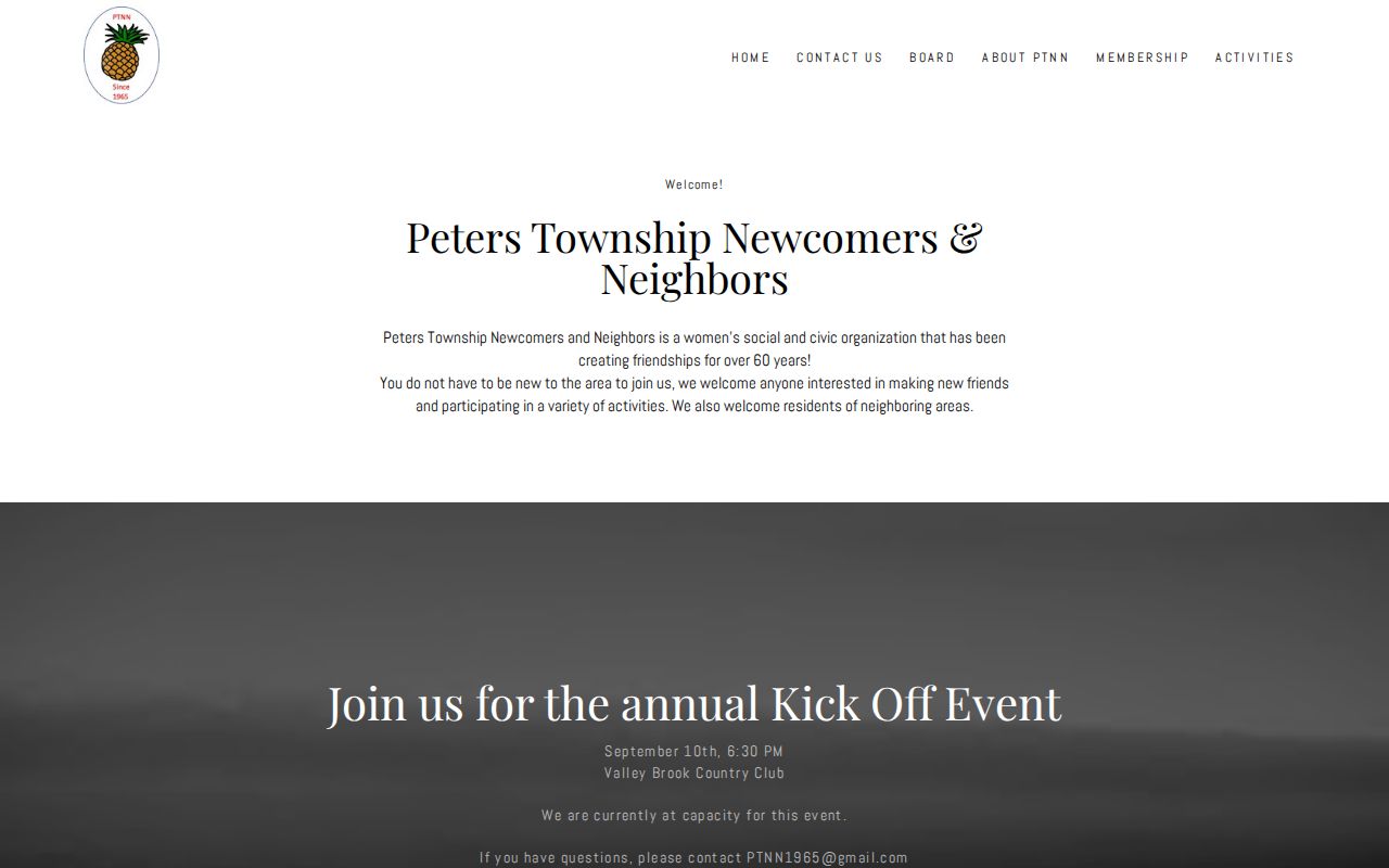
Public events and contact channels can help someone learn about community life without turning membership into an address claim. Check the organization directly before relying on a listed officer, program, or meeting detail because contacts can change.
Peters Township Block Records
Local maps add historical context when a current parcel line is not enough. The Township Maps page includes a Street and House Number Map current as of July 2024, along with zoning, land-use, and project maps. The current map is an orientation tool. It should not be treated as evidence of a past renumbering event, because the research found no authoritative Township street-renumbering year.
Peters Township Public Library Archives holds Township street, property, and street-and-house-number maps for 1978, 1979, 1985, 1987-89, 1992, 1997, 2000-01, 2004, 2006, 2008, and 2019. The archives also preserve Chamber guides and maps. Arrange archival access with the archivist, compare street, village, postal, lot, and plan variants, and cite the map date in a private research log. Historic maps locate roads and communities; they do not identify present occupants.
Peters Township Neighbor Privacy
Official sources and commercial lookup tools are not interchangeable. A county parcel map supplies a source-linked parcel, site address, and recorded-land route. A regulated voter list has legal request and use restrictions. Commercial categories can combine public and marketing data, may have old entries, may merge people with similar names, and often lack a clear source date. A polished result does not make it a custodial record.
| Category | Strength | Limit |
|---|---|---|
| Official parcel, Recorder, court, and election channels | Specific custodian, defined fields, and a way to check the underlying record | Each source only proves its own dated fact and may restrict access |
| Commercial lookup category | May provide a lead to check independently | Can be stale, combine sources, or confuse same-named people |
Pennsylvania protects information through record-specific rules. Court policy, vital-record law, Election Code restrictions, driver-data protections, and the Address Confidentiality Program can limit what appears in a record. The program can provide a substitute mailing address for eligible participants. Do not attempt to fill a protected gap with a second source or repeat data that appears improperly exposed.
Lawful use. Peters Township block research is for personal, historical, civic, and safety-aware purposes. Do not use parcel, voter, or organization information to stalk, harass, intimidate, or harm anyone.