
Peters Township Previous Residents by Era
Past residents are not found in one official roster. The reliable trail changes with the time period and the question. The current parcel helps establish the property identity. Recorded deeds then trace ownership, while an archive, telephone item, census schedule, or estate record can place a person in a historical setting. Start with the newest dependable record, retain its labels and dates, and move backward only when the prior link is documented.
The table distinguishes what each source can show from what it cannot. It avoids a common mistake: treating a title transfer as proof that every member of a household lived at the property.
| Source | Years It Covers | Where Held | What It Shows |
|---|---|---|---|
| Recorded deeds | 1781-current, per Recorder | Landex and Recorder public computers | Title transfers, parties, and legal-description chain, not every occupant. |
| Assessment, GIS, and property record | Current system; historic online depth not verified | Washington County Tax Revenue and GIS | Current parcel identity and an owner lead. |
| Township permits and plans | File-by-file availability | Township records request route and PTPL municipal archive | Project chronology and public applicant or owner clues. |
| M’Murray telephone directory | 1906 verified item | PTPL digital archives | Subscriber and locality information within the printed scope. |
| PTPL historical collections | Dates vary by collection | Local History Room by appointment | Maps, photographs, municipal, family, and school evidence. |
| Federal census | Through 1950 publicly released | National Archives and established access providers | Dated household enumeration, often without a modern street address. |
| Vital and estate records | State vital records from 1906; estate records from 1785 | PHMC, DOH, and Register of Wills | Family endpoints and legal roles, not direct street-address proof. |
For current address orientation, the county GIS route and the Tax Revenue gateway are practical. For older transfers, use the Recorder’s index. When a record cannot be reached online, Recorder public computers and county court terminals are documented alternatives.
Peters Township Previous Residents Parcel Start
The county’s GIS property map accepts a property ID, address, or owner in one type-ahead search. A result displays an owner name, Property ID, and Site Address, then opens parcel details with configured links to the Assessor, printable parcel summary, and Tax Collector. Save the property ID and the site-address label exactly. That is the bridge from a street address to property records.
Site address and owner mailing address are different facts. A tax notice may go to a post office box, agent, trust, family member, or a different home. The owner name may also represent multiple people or another record holder. Use the map and the Washington County Tax Revenue route as parcel evidence, not a list of everyone at a house.
| Current address | Use the Site Address wording shown in the county map result. |
|---|---|
| Parcel or Property ID | Carry this identifier into the assessment, deed, plan, and map research log. |
| Current owner spelling | Record the display exactly, including multiple parties or trust language. |
| Legal description | Capture it if displayed, because older instruments may not use a modern house number. |
| Sale reference | Use an instrument number or deed book and page from the property record when available. |
The county P.A.S. property system offers Owner, Address, Parcel, Advanced, and Map Search routes. Its sales placement fields are particularly useful when they provide a document number or book and page, because that reference is more precise than guessing from an address.
Peters Township Previous Residents Deed Trail
The Recorder of Deeds states that every deed from 1781 to the present is remotely available through Landex. That unusually deep range makes the grantor-grantee chain the strongest documented backbone for a Peters Township address history. It is a chain of ownership, not a promise that every past resident appears in a deed. Older rural instruments can depend on a lot, plan, adjoining land, tract, or legal description instead of the house number used today.
- From the parcel record, note the Property ID, current owner, site address, legal description, and any instrument or book-page reference.
- Search the current owner as a grantee in Landex to locate that person’s acquisition document.
- Record the deed’s grantor, recording date, instrument number or book and page, and legal-description details.
- Search that seller as a grantee to find the seller’s earlier acquisition, then repeat the same documented steps.
- When the chain changes through an estate, trust, divorce, sheriff sale, corporate event, or subdivision, follow the relevant Register of Wills, court, plan, or entity record instead of forcing a name match.
- Grantor
- The party transferring an interest in a recorded instrument.
- Grantee
- The party receiving that interest. A prior owner is often found by searching the current seller as a grantee.
- Chain of title
- The documented sequence of transfers and related title events affecting a parcel.
- Legal description
- The lot, plan, metes-and-bounds, or other land description that carries property identity across changing street addresses.
When Landex does not return the needed document, use the Recorder’s public-search computers at 95 W. Beau St., Suite 520. Ask about grantor-grantee indexes, Russell Index conversion, deed books, and index variants for the era. The counter is the documented fallback, not evidence that the chain has ended.
Peters Township Previous Residents Landex Search
The Landex Washington County document search has three visible retrieval modes: General, Instrument Number, and Book and Page. General searching requires the selected county and party input. Begin and end dates and document type can narrow a common surname. Instrument Number or Book and Page is the better route when a P.A.S. sales record already supplies the reference.
Landex’s Washington document-search interface shows the three routes used to locate a recorded instrument.
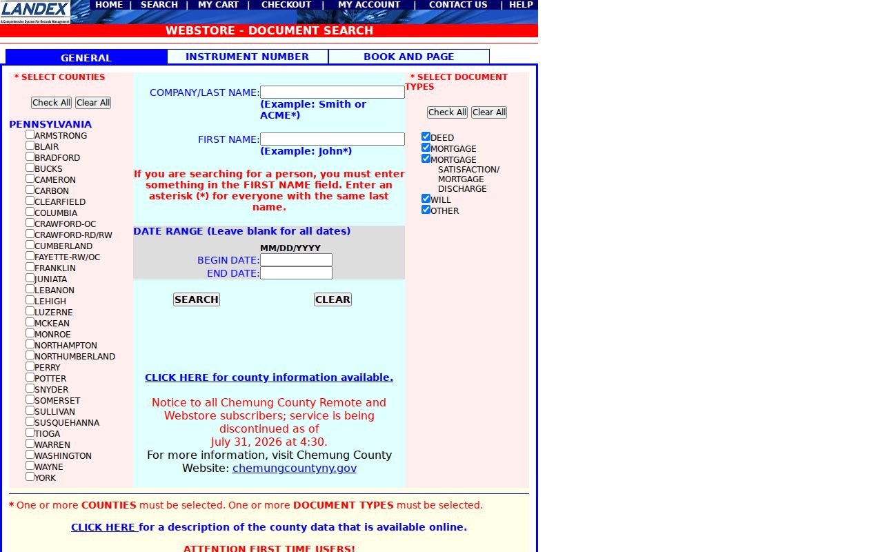
The screen confirms the retrieval choices, while the record itself supplies the meaningful chain detail. Landex documents `?` for one character and `*` for a string, with a 250-result limit for name searching. Narrow a broad result by date or document type rather than assuming the first surname result belongs to the property.
| Landex route | Required input | Use in an address history |
|---|---|---|
| General | Washington County and party input | Find a named grantee or grantor; add dates and type to control broad results. |
| Instrument Number | State, county, and instrument number | Open the exact deed reference supplied by a sales record or prior document. |
| Book and Page | State, county, book number, and page number | Reach an older cited deed when the book-page reference is known. |
Landex uses a cart and checkout workflow, with a $5 order-processing charge plus document price stated by its WebStore. Certified copies cannot be delivered online and must come from the courthouse. The Recorder fee bill lists research-copy charges, but a page should be checked at the time of an order because a recording fee is not an online image price.
Peters Township Past Residents Map Evidence
No authoritative Peters Township street-renumbering or renaming year was verified. A past residents search should not invent one to explain an address mismatch. Compare the current street name with the historical village or post-office name, subdivision plan, lot or block, and legal description. Search McMurray, Venetia, a named farm, or another historical place label where the source uses it. A Canonsburg, Pittsburgh, or Upper St. Clair postal label does not alone disprove Peters Township jurisdiction.
The local map ladder is substantial. PTPL’s Map Collection includes an 1817 Washington County map, the Peters Township page from Caldwell’s 1876 atlas with property-owner names, 1911 Carnegie Quadrangle farm-line maps, township street and property maps from 1978 through 2019, and municipal aerials for 1957, 1983, 1993, and 2000. These resources place an address or farm in geographic context. They do not independently prove a person lived there.
The 1993 historic-structure survey, prompted by the proposed Southern Beltway, documented 79 sites. Individual forms may include a photo, address, owner, tax ID, build date, use, materials, map, and notes, but listed form gaps must be acknowledged. No Peters Township Sanborn sheet or year set was verified, so the Library of Congress collection is only a discovery path rather than a claimed local source.
Peters Township Past Residents Census Evidence
Ownership is only one layer of a past household. A person named in a 1906 telephone directory, an open 1950 census schedule, a map collection, or a school item can add dated context after the property chain is established. The Peters Township Directory Book describes the local telephone, Chamber, and school collections in detail. Use them as records of the date and printed scope, not as a modern reverse directory.
A simple process keeps the household trail honest: property identity → dated recorded transfer → directory or telephone item near the relevant year → census schedule → archive, estate, or obituary source for a final check. The 1950 Census is the latest currently released full federal schedule. Federal census geography may use a township, enumeration district, post office, or nearby label rather than the modern street address.
- Choose one deed date or recorded owner as the fixed point.
- Locate a local directory-style item or census schedule from a close period.
- Compare the exact name variant, village, address or land description, role, and date.
- Record uncertainty when the same name could represent more than one person.
- Use a later estate, obituary, or court record only when its facts connect to the same documented trail.
Note: A matching surname is only a lead until date, place, record role, and a second independent source support it.
Peters Township Previous Residents Archives
The Peters Township Public Library Archives preserves the local materials that put a parcel trail into community context. Its Local History Room is accessed by arrangement with the archivist. Published finding aids cover municipal, school, Chamber, family, and other collections, while the archive also invites questions about unprocessed material. For a house-history request, provide the narrowest known name variant, date range, village or postal label, address or parcel, and a collection or box reference where one is known.
The PTPL Archives page is the source for appointment-based Local History Room access and finding aids.
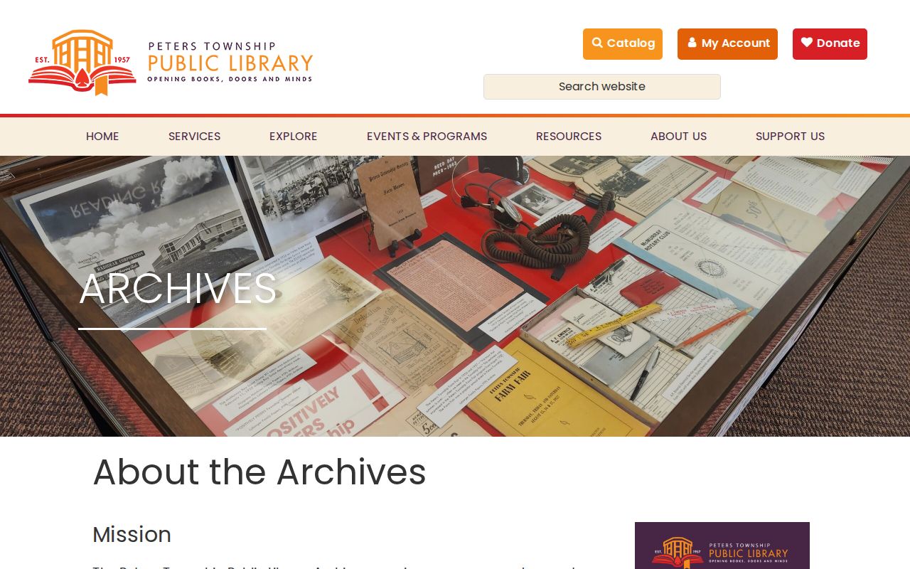
The archive is an alternate access channel when a web search stops. Its municipal-government records span 1803 to 2026, and the Township Book for 1803 to 1866 preserves administrative names in election, relief, auditor, and stray-animal records. Those entries can be historical leads, never a complete list of people at an address.
PTPL also holds the verified 1906 M’Murray telephone item and map resources that may bridge a deed description to a village or road. Ask for the citation, scan or copy cost, and any use restriction before ordering material. Do not ask staff to resolve identity from a common surname.
Peters Township Past Residents Estate Endpoints
An estate can explain why a deed chain changes names, but it should be researched at its own custodian. Washington County’s Register of Wills and Clerk of Orphans’ Court holds estate, Orphans’ Court, and marriage-license functions. The county genealogy page states that estate records reach back to 1785 and marriage records from 1885 to the present, with public terminal and written-request options. An actual filing is required to establish an executor, beneficiary, or heir relationship.
Public-age Pennsylvania birth and death material follows different rules. State certificates begin in 1906; archival birth records become public at 105 years and death records at 50 years. Use the state archives or Department of Health route that fits the record’s age and purpose. A vital event may clarify a family endpoint or county connection, but it is not street-address proof.
The Washington County Historical Society and county court genealogy resources are additional channels when a PTPL item supplies a narrow name or date. Confirm current response times, fees, and copy procedures before making a paid request.
Peters Township Previous Residents Research Limits
House history, family history, estate research, and neighborhood curiosity call for restraint. County property information describes parcels and owners, not every person who lived there. Township permits are not a public address index, and private utility, protected voter, confidential court, and Address Confidentiality Program information are not substitutes for a documented public record.
Lawful use. Use past-resident information for a specific personal or historical question, verify it with the custodian, and never use it to stalk, harass, or harm another person.
The Pennsylvania Right-to-Know Law is a request route for existing non-exempt agency records. It does not require a township or county office to create a custom list, search a proprietary system, disclose protected information, or override court, vital-record, voter-list, or ACP limits. When a record is restricted or the proof does not line up, leave the conclusion open.