
Start a Peters Township Street Directory
A full address is the strongest starting point for an address-record trail in Peters Township. Washington County's GIS map accepts an address, property ID, or owner and returns a result with an owner name, property ID, and site address when available. That result is a parcel lead, not a household list. Confirm that the selected parcel is in Peters Township, because McMurray, Venetia, Canonsburg, and other postal labels can occur in the township's record geography.
- Enter the full address in the Washington County GIS property map. Save the displayed site address and property ID, then open the detail panel.
- Follow the available Assessor link or use the Washington County Tax Revenue gateway to inspect the assessment record. Keep the site address separate from any tax mailing address.
- Use the property record's sales tab, when it supplies one, to copy an instrument number or deed book and page. Those references are safer than guessing that an older deed was indexed by a modern street name.
- Search the reference in Landex, selecting Washington County and the appropriate General, Instrument Number, or Book and Page route. Record the grantee, grantor, date, and legal-description clues.
- For older place context, compare the parcel with Township maps and ask Peters Township Public Library Archives about its scheduled Local History Room access and relevant maps or municipal records.
The chain remains address based at every stage: site address to parcel ID, parcel ID to property profile, then a recorded reference to a deed. A name found on a deed explains a transaction party. It does not by itself identify current residents along the street.
Note: Keep a log of the exact source, date, parcel identifier, and legal-description wording before moving to an earlier recorded instrument.
Peters Township Address Search in P.A.S.
The county's Property Records Public Access Site, commonly called P.A.S., is the assessment-side partner to address-by-address research in Peters Township. Its Address route requires a street name and can also take a street number, suffix, and direction. Owner, Parcel, Advanced, and Map Search routes serve different kinds of known information. The county says the property, sales, and tax-roll information is informational and not guaranteed current or error-free, so record labels matter.
| P.A.S. route | Observed field | Use for an address | Important limit |
|---|---|---|---|
| Address | Street, with optional Number, Suffix, and Direction | Find a parcel from a known Peters Township street address | Street is required for this route; no ZIP field was observed. |
| Owner | Owner in last-name, first-name format | Return to a known assessment party after a parcel is found | An owner entry is not a complete list of people at the site. |
| Parcel | Full or partial Parcel ID | Reopen a documented county parcel | Use the county's displayed identifier, not a reconstructed number. |
| Advanced | Owner, Parcel ID, sales date or price, street name or number | Combine available facts and choose result columns | Every criterion is optional until it is added to the search. |
The P.A.S. assessor interface shows the County's owner, address, parcel, advanced, and map search choices. Its property profile can lead to Parcel Info, Sales, Values, structures, photos, and map views. A sales entry may show an instrument number, deed book, deed page, grantor, and grantee. That is the documented handoff from the assessment side of an address workflow to the recorder index.
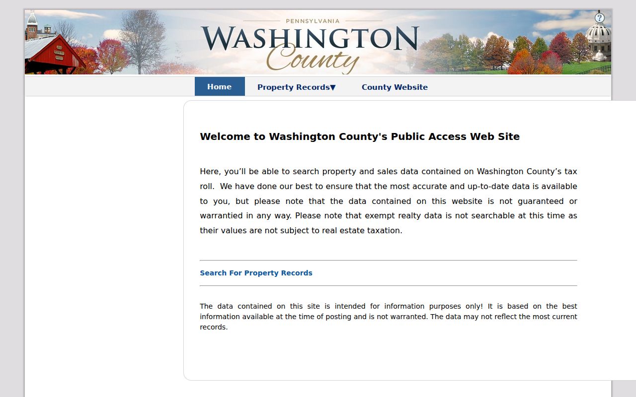
Use the screenshot as a route guide, then read the live record labels before relying on an individual result. The County distinguishes assessments, which levy real-estate assessments, from claims, which collect delinquent taxes. A tax or assessment item can illuminate a parcel's record history without establishing a list of people at the address.
Map Peters Township Streets Through GIS
The Washington County GIS property map uses one type-ahead box labeled “Search by property id, address, or owner.” Search results expose Owner Name, Property ID, and Site Address. After selecting a parcel, its Details tab may link to Assessor, Print Parcel Summary, Tax Collector, Pictometry, and other configured services. The map can also be clicked parcel by parcel. It has no verified street-browse, ZIP filter, radius search, or adjacent-resident button.
That boundary changes how parcel research should be read. For several addresses on the same road, repeat the parcel search for each specific address rather than treating a row of map polygons as an unverified roll of residents. Numeric addresses are not always adjacent legal parcels. Cul-de-sacs, easements, irregular boundaries, and subdivision plans can make a map sequence different from the legal relationship between lots.
- Parcel
- A county-defined piece of real estate used for mapping and assessment. Its ID links map research to property records.
- Situs address
- The physical location of the parcel. It is often shown as Site Address in the County GIS results.
- Plat
- A recorded subdivision or survey plan that can identify lots, blocks, and layout details relevant to a deed chain.
- Criss-cross directory
- An address-arranged historical directory. No verified Peters Township criss-cross run was found, so archive staff should be asked about individual holdings rather than assuming one exists.
Note: A map label is a discovery aid; confirm ownership, legal description, and document status with the assessment or recorder record.
Follow Peters Township Deeds in Landex
The Washington County Recorder of Deeds states that deeds from 1781 to the present are available remotely through Landex. That range makes the deed trail a major local strength, but the street address is often not the recorder's best search key. Start with the assessor or GIS parcel, then move through a current grantee, instrument number, book and page, lot reference, or legal description. Search a current owner as grantee to find an acquisition deed, then search the prior seller as grantee to continue backward.
The Landex Washington County document search provides General, Instrument Number, and Book and Page modes. General searching uses Washington County, party name, optional dates, and optional document type. The service documents ? for one character and * for a string, but a name query stops at 250 matches, so date and document-type limits matter for common names. Certified copies must come from the courthouse, not through online delivery.
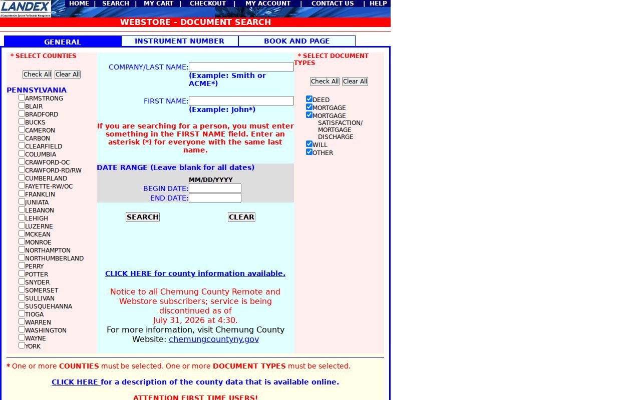
The Recorder maintains public-search computers at 95 W. Beau St., Suite 520, Washington, and lists 724-228-6806 for the office. Use that counter route if a web search has an account, payment, image, browser, or indexing problem. Ask which grantor-grantee index, book and page, instrument number, or Russell Index conversion applies to the period. The Recorder's current fee bill should be checked for any copy request, rather than assuming that a visible online index includes free document images.
Street Records for Peters Township Addresses
Several custodians hold different parts of a Peters Township street record. The records fit together when their limits are preserved. GIS locates a parcel. Assessments describe a county property record. The Recorder keeps enduring recorded documents. Township permits may document an application workflow, while courts and estates can provide dated public context only after the actual file and access rule are checked.
| Address-linked record | Custodian | What it can establish | Access channel |
|---|---|---|---|
| GIS parcel result | Washington County GIS | Site address, property ID, first owner displayed, map context | Online property map and GIS office |
| Assessment profile | Washington County Tax Revenue | Parcel, assessment, owner or mailing fields to the extent displayed | County gateway, Suite 525, 724-228-6850 |
| Deed or subdivision plan | Washington County Recorder of Deeds | Transaction parties, recording facts, legal description, plan links | Landex, public computers, or Recorder counter |
| Permit or planning file | Peters Township | Public application or project chronology where a file is available | Township permits and a narrow RTKL request |
| Estate or court file | Washington County courts | Dated public case or estate context | C-Track guidance and counter terminals |
A property profile may show a mailing address. Treat it as a tax-routing field, not a claim that the owner occupies the Peters Township site. It may lead to a post-office box, representative, trust, or another address. Likewise, a homestead field is an assessment indicator, not a substitute for a current-residency finding.
Peters Township Street Maps Set Context
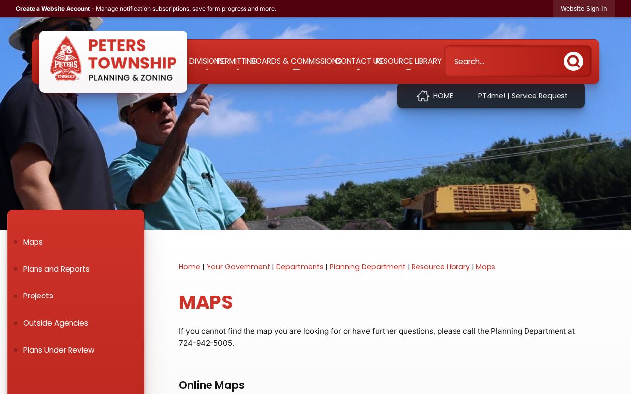
Before placing a street in a county record, consult the Township's Street and House Number Map, dated July 2024. It provides the local orientation step when a mailing city says McMurray or Venetia but the government jurisdiction is Peters Township. The map is current address geography, not evidence of a township-wide renumbering event. Research did not verify an authoritative renumbering or street-renaming year.
For an older address, Peters Township Public Library Archives holds street and property maps from 1978 through 2019, along with historic aerials and a map collection. That collection includes an 1817 county map, the 1876 Caldwell atlas with Peters Township on page 143, and 1911 Carnegie Quadrangle farm-line maps. Match historic village, road, plan, lot, and legal-description clues instead of forcing an old address into a modern house-number format.
The 1993 historic-structure survey, prompted by the proposed Southern Beltway, documented 79 local sites. Individual forms can include location, owner, tax ID, build-date, and map details, although the research notes that listed form gaps must be acknowledged. It is a useful historic-address lead, not an automatic confirmation of who occupied a property.
Note: Preserve the source's McMurray, Venetia, farm, village, road, or postal wording when comparing records from different periods.
Peters Township Street Permits and Plans
Peters Township permits and applications use SDL for applicants. The documented process asks the applicant to select Peters Township, choose a permit type, provide owner information and, when applicable, contractor information, then upload required supporting material and sign electronically. Certain building, zoning, fence, and demolition applications require a plot plan or survey. Status tracking, document exchange, and inspection scheduling are part of the account workflow.
SDL is an authenticated applicant portal, not a public street lookup. No public address-search interface for permits, inspections, code cases, or applications was verified. For an existing non-exempt township record, use the Township's record-request form to make a focused request. Pennsylvania's Right-to-Know Law is the route for existing non-exempt agency records, but it does not override court rules, recorder copy practices, confidentiality protections, or records that do not exist.
Voter Street Lists in Peters Township
Pennsylvania's Check My Registration Status route is for an individual to check that person's own status online, by phone, or through the county office. It is not a public browse-by-street directory. Washington County Elections maintains the registration database and says voter-information requests require a form. The state also lists 1-877-VOTESPA as an information channel.
The regulated public-list process is different. The Department of State voter-list request form identifies Public Information, Street, Walking, and Full Voter Export list products. A Street List has name, residential address, mailing address, party, and status fields; a Walking List omits the mailing address. The form requires requester information, county scope, and a signed certification. It lists $20 per county for the non-export list types, delivered electronically.
The form cites 25 Pa.C.S. §§ 1403 and 1404 and limits use to election, political, or law-enforcement purposes. It bars internet publication. Route questions to Washington County Elections, 95 W. Beau St., Suite G10, Washington, at 724-228-6750. A voter record can have regulated status and address data, but it never reveals ballot choices and should never be treated as a general contact list.
Peters Township Street Archive Context
Historic address work often begins before a present-day street number. The Peters Township Public Library Archives offers Local History Room finding aids, maps, municipal records, photographs, and selected digitized material, with archive visits arranged with the archivist. Its municipal-government records span 1803 to 2026. The fragile Township Book from 1803 to 1866 records election sites, auditor reports, relief authorizations, and stray-animal reports, each of which may place a local name in a dated administrative setting without becoming a complete resident roll.
County and state material supplies another fallback. The PHMC Washington County records guide inventories historic deeds, grantor-grantee indexes, mortgages, wills, marriage records, and naturalization material. For a remote dead end, the documented chain is the office counter, a narrow request to the correct agency custodian, PTPL Archives for local holdings, then PHMC or the State Archives for older statewide material. Do not use an RTKL request to bypass a court or Recorder access rule.
Limits of a Peters Township Street Directory
These Peters Township street and address records can document public property trails. They cannot turn those trails into a complete list of everyone at an address. County parcel data usually identifies a parcel and its assessed owner, not all occupants. It does not disclose private utility accounts, delivery information, driver-license addresses, protected voter records, or confidential court parties. A missing record can reflect a different spelling, historic village label, unrecorded relationship, restricted file, or a record series that never existed.
The Pennsylvania Address Confidentiality Program can provide a substitute mailing address in voter registrations and court or state records for enrolled participants. Public records also change. Verify a result with the custodian that holds it, especially before relying on its date, parcel connection, or legal effect. Personal, lawful research calls for restraint, precision, and respect for protections built into the record systems.